Thanks to the Monty Python team we are all well aware of the claims of the Roman Empire and its relentless propaganda machine which has disseminated its brand of education/indoctrination for 2,000 years.
I wrote about how the Roman Empire appeared to fall but was, in fact, merely relocated, rebranded and continued clandestinely in plain sight:
In the days before reading and writing were common, symbols conveyed ideas. The killing of the bull is symbolic of murdering nature, dominating nature and, let's face it, that is precisely what the Roman Empire, the Venetian Black Nobility and now the Crown Corporation …
Our education and all forms of media claim that the Roman Empire provided their Empire with many facilities for which we should be eternally grateful.
How true is this claim?
Let’s examine the evidence for each of the claims mentioned in the Monty Python comedy sketch.
AQUEDUCTS
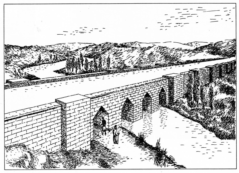
An artist impression of the Jerwan Aqueduct
Contrary to virtually every reference online, there was an aqueduct built at Jerwan, a locality north of Mosul in the Nineveh Province of Iraq between 703 and 690 BC. It was part of a huge irrigation system to water Ninevah's extensive gardens, with water diverted from Khenis gorge, 50 km to the north. Some scholarsbelieve the legends of the Hanging Gardens of Babylon were actually Sennacherib’s extensive gardens in Nineveh, not Babylon.
Jerwan Aqueducts today
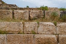
Jerwan Aqueducts stone blocks
An inscription on the aqueduct reads: "Sennacherib king of the world, king of Assyria. Over a great distance I had a watercourse directed to the environs of Nineveh, joining together the waters.... Over steep-sided valleys I spanned an aqueduct of white limestone blocks, I made those waters flow over it."
This aqueduct was constructed of more than two million dressed stones and using stone arches and waterproof cement. It predated anything the Romans built by five centuries and was probably not the only construction of its type in the region. It would seem that the Romans adopted this idea rather than inventing it themselves.
SANITATION
The first sanitation facility was the sump or cesspit that appeared in Babylon around 4000 B.C. A simple digging in the ground to concentrate the excreta that could soon be found in other cities of the empire and in rural areas. The Babylonians had already developed a basic hydraulic system for the transport of water and they applied their knowledge to the conduction of faeces to the sumps by means of the washing down with buckets of water and the first clay pipes.
The water supply already existed in cities at that time, but it was not until 3000 B.C., in the city of Mohenjo-Daro, in the Indo valley (in modern-day Pakistan) that we find the first buildings with latrines connected to a sewage system. The citizens washed down their latrines with water and the sewage system collected this waste water and took it to the sump or to the Indo River.
The first use of waste water for agricultural fertilization can be found in ancient Greece, due to the lack of wide rivers. In some cities the sewage system took the waste water to the outskirts of the city towards a dumping site. From here it was conducted to the crop fields by means of a piping system. ~ We Are Water Foundation
ROADS
Egyptian transportation experts designed the first paved road in existence, a seven-and-a-half mile stretch located on the western bank of the Nile, known as Giza Road. Historians say it is 4,600 years old, and in places is about six and a half feet wide. It is reputed to have been built to transport stones for the pyramids.
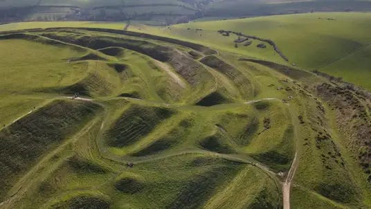
Britain also had roads long before the Romans invaded. A road connecting merchants of the Dorset coast with merchants in East Anglia, still exists, albeit in a different form. It’s called the Ridgeway, and this road today is only a 95 mile long trail but originally it was hundreds of miles long. It was used for thousands of years as a trading route. We still see several Durotriges Celtic hill forts in my home county of Dorset as mentioned from the 10th minute of this video.
The prehistoric earth works of Maiden Castle which is on the Dorset ridgeway.
IRRIGATION
The oldest irrigation system in the world is in China. Called Dujiangyan, it is also the only surviving monumental non-dam irrigation system from the ancient past. A marvel of Chinese science and engineering, Dujiangyan was built over 2,200 years ago. This system is still used to irrigate over 668,700 hectares of farmland, drain floodwater, and it provides water resources to more than 50 cities in the Sichuan province today.
The ‘Fish Mouth’ levee. Part of the Dujiangyan irrigation system.
Dujiangyan is the brainchild of Li Bing, a local official of Sichuan Province over two millennia ago. It arose to confront the frequent flooding of the Minjiang River, a tributary of the Yangtze River. Li Bing and his son discovered the river was overflowing due to spring melt-water coming from the mountains which burst the banks of the slow-moving waters below. A dam was out of the question as Li Bing had been told to keep the waterway open for military vessels. Thus, Li Bing’s solution was to create an artificial levee which could move some of the water to another area and then make a channel in Mount Yulei to send the excess water to the dry Chengdu Plain. The levee was made of long sausage-shaped baskets of woven bamboo filled with stones known as Zhulong, held in place by wooden tripods known as Macha.
Traditional Chinese Medicine (TCM) is one of the oldest medical systems in the world. Its earliest treatise, by Huang Ti, the Yellow Emperor, and his physician Ch’i Pai via the book, Nei Ching, The Yellow Emperor’s Classic of Internal Medicine, lays out the traditional view of healthy living propounded in their time. However, throughout the book Ch’i Pai references “the ancients” as his source of information.
TCM views most diseases as a form of disharmony between the body and its environment. There is also a concept of qi or chi whichis an energy flowing through channels in the human body.
During the same period of history, Indian medical practices were well developed, known as Ayurveda. Also, Greek Hippocratic physicians were writing on similar veins. All three systems drew on an ancient philosophy picturing humanity as a microcosm reflecting the macrocosm of the Universe. All three proposed a combination of diet, exercise, folk tales and a vast knowledge of herbal remedies, the origins of which predate the written word.
As the Silk Road reached from Rome to China it can be presumed that the Romans availed themselves of the knowledge imparted at many traditional resting places and Taoist hostels along the way. The Taoist tradition was to provide hospitality and healing to travellers and simultaneously, they would gather information about herbs and other healing modalities from the communities that the Silk Road passed through. This information was conveyed back to China and makes up the vast literature compiled in TCMs Materia Medica and multiple books of healing strategies.
The earliest known formal school was developed in Egypt's Middle Kingdom under the direction of Kheti, treasurer to Mentuhotep II (2061-2010 BC).
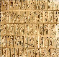
In Mesopotamia, the early logographic system of cuneiform script took many years to master. Thus only a limited number of individuals were hired as scribes to be trained in its reading and writing. Only royal offspring and sons of the rich and professionals, such as scribes, physicians, and temple administrators, were schooled.
Most boys were taught their father's trade or were apprenticed to learn a trade.Girls stayed at home with their mothers to learn housekeeping and cooking, and to look after the younger children. Later, when a syllabic script became more widespread, more of the Mesopotamian population became literate. Later still in Babylonian times there were libraries in most towns and temples; an old Sumerian proverb averred "he who would excel in the school of the scribes must rise with the dawn."
There arose a whole social class of scribes, mostly employed in agriculture, but some as personal secretaries or lawyers.Women as well as men learned to read and write, and for the Semitic Babylonians, this involved knowledge of the extinct Sumerian language, and a complicated and extensive syllabary.
Vocabularies, grammars, and interlinear translations were compiled for the use of students, as well as commentaries on the older texts and explanations of obscure words and phrases. Massive archives of texts were recovered from the archaeological contexts of Old Babylonian scribal schools known as edubas (2000–1600 BCE), through which literacy was disseminated. The Epic of Gilgamesh, an epic poem from Ancient Mesopotamia is among the earliest known works of literary fiction. The earliest Sumerian versions of the epic date from as early as the Third Dynasty of Ur (2150–2000 BC).
Ashurbanipal (685 – c. 627 BC), a king of the Neo-Assyrian Empire, was proud of his scribal education. His youthful scholarly pursuits included oil divination, mathematics, reading and writing as well as the usual horsemanship, hunting, chariotry, soldierliness, craftsmanship, and royal decorum. During his reign he collected cuneiform texts from all over Mesopotamia, and especially Babylonia, in the library in Nineveh, the first systematically organized library in the ancient Middle East,which survives in part today.
In ancient Egypt, literacy was concentrated among an educated elite of scribes. Only people from certain backgrounds were allowed to train to become scribes, in the service of temple, pharaonic, and military authorities. The hieroglyph system was always difficult to learn, but in later centuries was purposely made even more so, as this preserved the scribes' status. Literacy remains an elusive subject for ancient Egypt. Estimations of literacy range from 1 to 5 per cent of the population, based on very limited evidenceto much higher numbers. Generalisations for the whole country, even at a given period, inevitably mask differences between regions, and, most importantly, between urban and rural populations. They may seriously underestimate the proportion of the population able to read and write in towns; low literacy estimates are a regular feature of 19th and 20th century attitudes to ancient and medieval (pre-Reformation) societies.
China’s formal education system was established more than two millennia ago. The imperial education and examination system in China is estimated to have been founded as early as the Han dynasty (202BC), and is strongly based on meritocratic ideals that persist in Chinese education to this day.
In ancient Israel, the Torah (the fundamental religious text) includes commands to read, learn, teach and write the Torah, thus requiring literacy and study. In 64 AD the high priest caused schools to be opened.
WINE
The Greeks had Dionysus – the ancient Greek god of wine, among other things – who was worshipped as early as 1500-1100BC and referenced in the works of Homer and Aesop. Mentions of wine can be traced back to Georgia in 6000BC, Iran in 5000BC and Sicily in 4000BC, and the Egyptians also tried their hand at winemaking with all kinds of grapes, as well as with figs, dates and pomegranates. The alcohol is even mentioned 231 times in biblical literature.
An international team of researchers suggest that the oldest winery is located close to both Georgia and Iran, in the former Soviet republic of Armenia. It was during their 2007 research expedition into a multicomponent site called Areni-1 cave – a late Chalcolithic/Early Bronze Age ritual site and settlement near the Areni village along the Arpa River – that a drinking bowl, grape seeds, desiccated vines, pottery sherds and fermentation jars were discovered and dated as 6,100 years old with the grapes in question most likely the vitis vinifera species, according to botanists.
Areni-1 cave
Further work carried out by researchers suggests that the Areni-1 winery is the oldest by about a thousand years. A winery in the Judea and Samaria area in Israel is said to be the second oldest.
PUBLIC BATHS
The earliest public baths are found in the ruins in the Indus Valley bronze age civilization. According to John Keay, the "Great Bath" of Mohenjo Daro in present-day Pakistan was the size of 'a modest municipal swimming pool', complete with stairs leading down to the water at each one of its ends.
The bath is housed inside a larger—more elaborate—building and was used for public bathing. The Great Bath and the house of the priest suggest that the Indus had a religion.
In Greece by the sixth century BC, men and women washed in basins near places of physical and intellectual exercise. Later gymnasia had indoor basins set overhead, the open maws of marble lions offering showers, and circular pools with tiers of steps for lounging.
Bathing was ritualized, and becoming an art, with cleansing sands, hot water, hot air in dark vaulted "vapor baths", a cooling plunge, and a rubdown with aromatic oils. Cities all over Ancient Greece honoured sites where "young ephebes stood and splashed water over their bodies".
Greek public bathing spread to the already rich ancient Egyptian bathing culture, during Ptolemaic rule and eventually to ancient Rome.
PUBLIC ORDER
The history of lawgiving is vast and pre-dates the Roman Empire by millennia. The sources mix and match in a head-spinning maelstrom. According to Wikipedia:
Ancient Egyptian law, dating as far back as 3000BC, was based on the concept of Ma'at, and was characterised by tradition, rhetorical speech, social equality and impartiality.By the 22nd century BC, Ur-Nammu, an ancient Sumerian ruler, formulated the first extant law code, consisting of casuistic statements ("if... then..."). It contains strong statements of royal power like "I eliminated enmity, violence, and cries for justice."
Around 1760BC, King Hammurabi further developed Babylonian law, by codifying and inscribing it in stone. Hammurabi placed several copies of his law code throughout the kingdom of Babylon as stelae, for the entire public to see; this became known as the Codex Hammurabi. The most intact copy of these stelae was discovered in the 19th century by British Assyriologists, and has since been fully transliterated and translated into various languages, including English, German and French.
Ancient Greek has no single word for "law" as an abstract concept, retaining instead the distinction between divine law (thémis), human decree (nomos) and custom (díkē).Yet Ancient Greek law contained major constitutional innovations in the development of democracy.
Ancient India and China represent distinct traditions of law, and had historically independent schools of legal theory and practice. The Arthashastra, dating from the 400BC, and the Manusmriti from 100BC were influential treatises in India, texts that were considered authoritative legal guidance. Manu's central philosophy was tolerance and pluralism, and was cited across South East Asia. During the Muslim conquests in the Indian subcontinent, sharia was established by the Muslim sultanates and empires, most notably Mughal Empire's Fatawa-e-Alamgiri, compiled by emperor Aurangzeb and various scholars of Islam.
Do check out the rest of the articles in the Wikipedia series if you are keen to know how the ancient ideas for law developed around the world. https://en.wikipedia.org/wiki/Category:Law
PEACE
Finally, can we honestly say that the Roman Empire ever brought any peace to the lands it conquered? Did it even inherit any peace from its predecessors?
In fact, has it, at ANY time, done anything original? Or has it stolen every idea humanity ever had and lauded itself in self congratulatory arrogance?
It doesn’t have a single good idea that it can truly claim as its own….
NOT EVEN THE MEGALOMANIACAL AVARICE IT OBSESSES OVER!
It has done nothing but steal, control, suppress and discourage - all in the vain attempt to OWN the entire planet on the lines of that God-forsaken mental midget Nimrod, the first confirmed psychopath!
ROADS. In his "History of Britain," (1848) R W Morgan says:
"In addition to being one of the founders of British Legislation, Dyvnwal designed and partly made the Royal British Military Roads through the Island. These were nine in number:
1. The Sarn Gwyddelin (corrupted into Watling Street), or Irish Road, in two branches, from Dover to Mona (Anglesey) and Penvro.
2. The Sam Iken (Iknield street), the road from Caer Troia (London), northward through the Eastern districts.
3. Sam Ucha (Iknield street), from the mouth of the Tyne to the present St. David's.
4. Sam Ermyn, from Anderida (Pevensey) to Caer Edin (Edinburgh).
5. Sam Achmaen, from Caer Troia to Menevia (St. David's).
6. Sam Halen, from the Salt Mines of Cheshire to the mouth of the Humber.
7 Sam Hàlen, from the Salt Mines to Llongborth (Portsmouth).
8. The Second Sam Ermyn, from Torbay to Dunbreton on the Clyde.
9. The Sam ar y Môr, or military road following the coast around the Island.
These roads were pitched and paved, and ran sometimes in a straight, sometimes a sinuous line, at a moderate elevation above the ground, forming a network of communication between the cities of Britain. Being completed by Belinus, they are known as the Belinian roads of Britain. The Romans followed these lines in their first and second invasions, and subsequently laid down in great measure their own military roads upon them. Hence the Belinian and Roman roads are found constantly running in and out of each other."


")


PODCAST WITH JERM WARFARE:
https://open.substack.com/pub/francesleader/p/the-black-nobility-podcast
ROADS. In his "History of Britain," (1848) R W Morgan says:
"In addition to being one of the founders of British Legislation, Dyvnwal designed and partly made the Royal British Military Roads through the Island. These were nine in number:
1. The Sarn Gwyddelin (corrupted into Watling Street), or Irish Road, in two branches, from Dover to Mona (Anglesey) and Penvro.
2. The Sam Iken (Iknield street), the road from Caer Troia (London), northward through the Eastern districts.
3. Sam Ucha (Iknield street), from the mouth of the Tyne to the present St. David's.
4. Sam Ermyn, from Anderida (Pevensey) to Caer Edin (Edinburgh).
5. Sam Achmaen, from Caer Troia to Menevia (St. David's).
6. Sam Halen, from the Salt Mines of Cheshire to the mouth of the Humber.
7 Sam Hàlen, from the Salt Mines to Llongborth (Portsmouth).
8. The Second Sam Ermyn, from Torbay to Dunbreton on the Clyde.
9. The Sam ar y Môr, or military road following the coast around the Island.
These roads were pitched and paved, and ran sometimes in a straight, sometimes a sinuous line, at a moderate elevation above the ground, forming a network of communication between the cities of Britain. Being completed by Belinus, they are known as the Belinian roads of Britain. The Romans followed these lines in their first and second invasions, and subsequently laid down in great measure their own military roads upon them. Hence the Belinian and Roman roads are found constantly running in and out of each other."
https://www.thenationalcv.org.uk/More%2016%20History%20of%20Britain%20%20by%20R%20W%20MORGAN%20(1848)%20(2).pdf (pp.25-26)